|
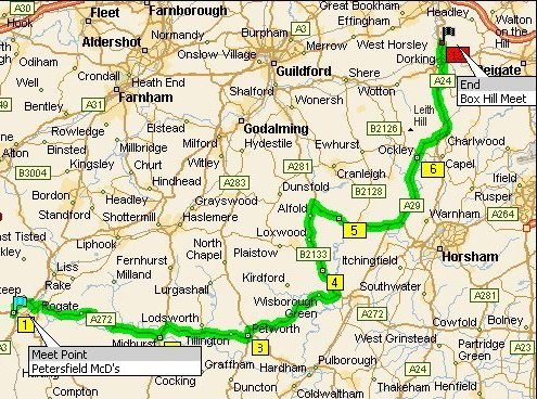
Box Hill Rideout Petersfield to Box Hill Driving distance: 97 miles For printable
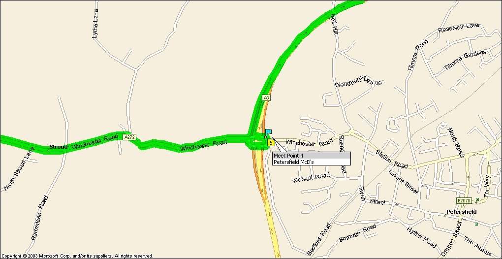
version Click Here Meet Point –
Petersfield McD’s Map Click here Itinerary for route: |
|
|||
Mile
|
Instruction
|
For
|
|
|
|
0.4 |
At roundabout, take the FIFTH exit onto Ramp |
0.4 m |
|
|
|
1.2 |
Merge onto A3 |
0.8 m |
|
|
|
2.1 |
Take Ramp (LEFT) onto A272 |
0.9 m |
|
|
|
2.8 |
At roundabout, take the FIRST exit onto A272 [ |
0.7 m |
|
|
|
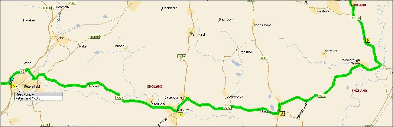
11.2 |
Turn RIGHT (South) onto A272 |
8.4 m |
|
|
|
12.2 |
At near Midhurst, turn LEFT to stay on A272
[Rumbolds Hill] |
1.0 m |
|
|
|
17.8 |
Turn RIGHT (East) onto A272 |
5.6 m |
|
|
|
18.2 |
At near Petworth, stay on A272 [ |
0.4 m |
|
|
|
25.1 |
Turn RIGHT (East) onto A272 |
6.9 m |
|
|
|
27.1 |
Turn LEFT (North) onto B2133 |
2.0 m |
|
|
|
31.9 |
At B2133, Wisborough Green, Billingshurst RH14 0,
stay on B2133 (North) |
4.8 m |
|
|
|
31.9 |
Road name changes to Local road(s) |
21 yds |
|
|
|
34.0 |
Turn RIGHT (South) onto A281 [ |
2.1 m |
|
|
|
37.3 |
At near Tismans Common, stay on A281 [ |
3.3 m |
|
|
|
38.1 |
At roundabout, take the FIRST exit onto A29 [ |
0.8 m |
|
|
|
42.7 |
At roundabout, take the FIRST exit onto A29 [ |
4.6 m |
|
|
|
45.5 |
At |
2.8 m |
|
|
|
48.7 |
Merge onto A24 [ |
3.2 m |
|
|
|
51.1 |
At roundabout, take the SECOND exit onto A24 [ |
2.4 m |
|
|
|
51.8 |
At roundabout, take the SECOND exit onto A24 [ |
0.7 m |
|
|
|
51.8 |
Enter roundabout and take SECOND Exit To back on car
park |
43 yds |
|
|
|
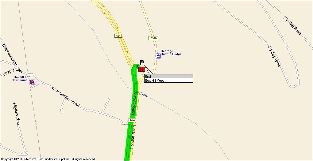
52 |
Arrive
End Box Hill
|
|
|
|